At K&A Engineering, our professional staff has a wealth of knowledge and a vast range of experience. Our staff is able to provide competent and qualified services for engineering, design, and survey exclusive projects. Our services include aerial mapping, boundary surveying, topographic mapping, construction staking in all phases, from rough grade to finish, utility layout, commercial construction projects, governmental contracts, ALTA/ACSM title surveys, and a number of other services related to the boundary, mapping, design or construction of an engineering related survey project. All of our surveying services are completed in the most professional and proficient manner possible, utilizing the strengths and experience of our staff and latest technologies in survey equipment and software to provide our clients with outstanding quality. We have developed a strong reputation for proactive communication with our clients and contractors to avoid problems in the field before they occur.
Survey Services
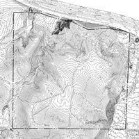
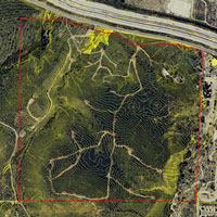
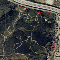
K&A Engineering provides aerial mapping services which include horizontal and vertical control, aerial target placement and photo reconnaissance. Our digital mapping is provided by highly qualified and experienced consultants.
K&A Engineering provides aerial mapping services which include horizontal and vertical control, aerial target placement and photo reconnaissance. Our digital mapping is provided by highly qualified and experienced consultants.
K&A Engineering provides Topographic Survey services to meet mapping requirements and our client’s needs by employing the best and most efficient survey tools available.
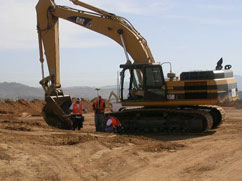
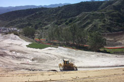
K&A Engineering’s capable and very experienced survey staff provides staking for all phases of construction and layout staking required. We have complete staking on a wide variety of projects, ranging from single residential homes to mass grade projects moving tens of millions of yards of dirt, horizontal and vertical staking for utility construction, to infrastructure improvement projects. Additionally our staff is highly proficient with commercial and industrial development staking with building layout, parking lot staking and landscape improvements.
K&A Engineering provides A.L.T.A. Surveys on all type of properties from raw land to highly developed Industrial/Commercial properties. A.L.T.A./ACSM Surveys are supervised by our licensed surveyors and performed by our knowledgeable field survey staff. Our A.L.T.A./ACSM Maps are prepared to meet the requirements of the most current standards for certification, including any schedule A items.
Survey Staff
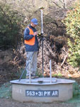
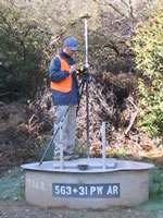
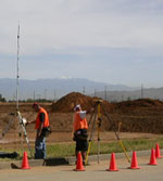
At K&A Engineering, our team of Licensed Surveyors, experienced crew chiefs, and qualified support staff have extensive knowledge and a wide range of expertise. The majority of our professional staff have decades of experience, in and out of the field. Our five-plus field crews are knowledgeable and experienced, able to perform on any survey task. All of our field crews are supervised by licensed survey professionals and supported by our office staff. Nearly all of our construction staking and preliminary boundary calculations are provided by our office staff, making our survey crews time in the field efficient and productive. Additionally each crew is equipped with, and trained to utilize the most up-to-date survey equipment and technologies, which further increases the comprehensive abilities of our survey field crews.
Survey Equipment
At K&A Engineering, we are committed to providing the most proficient and productive survey services available. Part of this commitment is providing our survey crews and support staff with the technologies, equipment and training to make each task as efficient as possible. Each of our survey field crews is equipped with an up-to-date survey tool box which includes: GPS (Global Positioning System), RTK (Real Time) receivers, Robotic Total Station EDM (Electronic Distance Meter), Handheld PC/Windows-Based Data Collectors using TDS (Tripod Data Systems) Software, and a full compliment of conventional survey tools to complete the assigned tasks. Our office staff is equally well-equipped to provide quality services using PC-Based Software. Our primary tool is AutoDesk Land Development Desktop (LDD), which provides excellent field-to-finish flow and the quality of finished products we are proud to provide to our clients. We also employ a wide variety of other mapping, processing and reduction software that provide the high level of support we strive to maintain for our survey crews.
K&A Engineering utilizes a top of the line GPS Survey System capable of real-time positioning, with accuracies acceptable for a wide range of survey tasks.
K&A Engineering utilizes top of the line, fully robotic total station electronic survey instruments for all of our survey field crews. These instruments are extremely efficient and accurate. They are a perfect compliment, providing quality and value to our clients.
K&A Engineering uses very efficient and stable handheld PC/Window-Based Data Collection Equipment that flows seamlessly between all of the methods employed to gather survey data. Once collected, the information is seamlessly transferred to the office to create the basis for our engineering projects and client deliverables.

K&A Engineering has invested in, and is committed to continuing to provide survey services at the highest level possible. K&A Engineering’s survey staff is encouraged to continue developing through education and experience.